


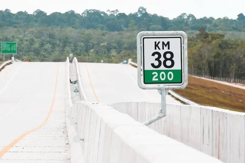
Inp.polri.go.id - Jakarta. Drivers need to understand how to read toll road kilometer markers. locally known as patok kilometer, to accurately identify their location during emergencies.
The rectangular markers are installed every 200 meters along toll roads and feature two primary data points. The top section, written in black text on a white background, indicates the main kilometer position. The bottom section, displayed in white text on a green background, shows the hectometer value, representing the additional distance in meters from the reference kilometer mark. For instance, a marker reading "KM 214" on top and "200" below indicates the position is at KM 214+200.
Understanding these markers allows motorists to provide precise coordinates to emergency operators during vehicle breakdowns or accidents, enabling faster response times from highway patrol units.
(mg/nf/pr/rs)